
This archive contains answers to questions sent to Unidata support through mid-2025. Note that the archive is no longer being updated. We provide the archive for reference; many of the answers presented here remain technically correct, even if somewhat outdated. For the most up-to-date information on the use of NSF Unidata software and data services, please consult the Software Documentation first.
Hi Kwan,
Sorry I was not able to get to this before now...
re:
> Onto a different problem, I have obtained some GOES-7 AREA files (1991)
> from NOAA CLASS. I was able to define the data set and IMGLIST appeared to
> read these multi-band images correctly. But I could not seem to get
> IMGDISP to display the data correctly. I only get some random horizontal
> lines across. I am not sure if these old AREA files need to be read
> differently. So I am sending you one of these files for you to examine.
I extracted the AREA file you attached; created an ADDE dataset for it
and have no problems listing or displaying the data from it:
DSSERVE LIST GOES7
Group/Descriptor Type Format & Range RT Comment
------------------------ ----- ------------------ -- --------------------
GOES7/IR IMAGE AREA
DIRFILE=/home/mcidas/workdata/goes07.1991.301.1801.A
REA_IR "GOES-7 IR from CLASS via Kwan
DSSERVE: done
IMGLIST GOES7/IR FORM=ALL
Image file directory listing for:GOES7/IR
Pos Satellite/ Date Time Center Res (km) Image_Size
sensor Lat Lon Lat Lon
--- ------------- ------------ -------- ---- ---- ----- ----- ------------
1 GOES-7 IR 28 OCT 91301 18:01:00 23 99
Band: 7 12.7 um Water vapor detection 7.81 3.04 637 x 3822
Band: 8 11.2 um Night cloud detection, sfc temp 7.81 3.04 637 x 3822
Band: 10 6.7 um Water vapor detection 7.81 3.04 637 x 3822
proj: 0 created: 0000000 0 memo: AAA transcribed archive data
type:AAA cal type:RAW
offsets: data= 1280 navigation= 256 calibration= 768 auxiliary= 0
doc length: 512 cal length: 116 lev length: 12 PREFIX= 644
valcod: -1 zcor: 1 avg-smp: N
pdl: 87 87 3 0 0 0 8A 8A 0 0 0 0 0 0 0 0
0 0 0 0 0 0 10 0 0 73 6 33 96 1 B0 7
start yyddd: 1991301 start time:180103 start scan: 0
lcor: 1681 ecor: 1 bytes per pixel: 2 ss: 33
Resolution Factors (base=1): Line= 8.0 Element= 4.0
IMGLIST: done
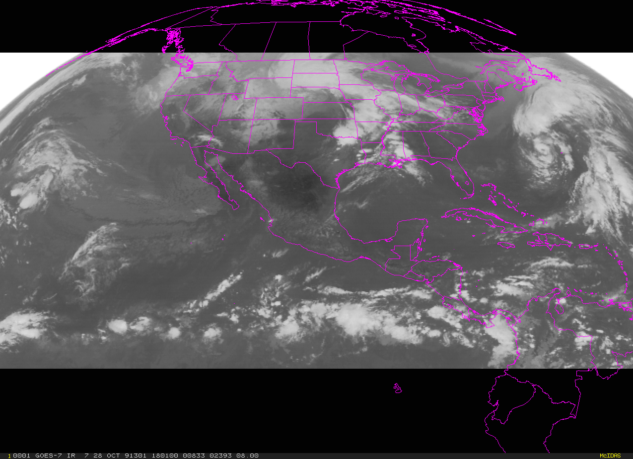
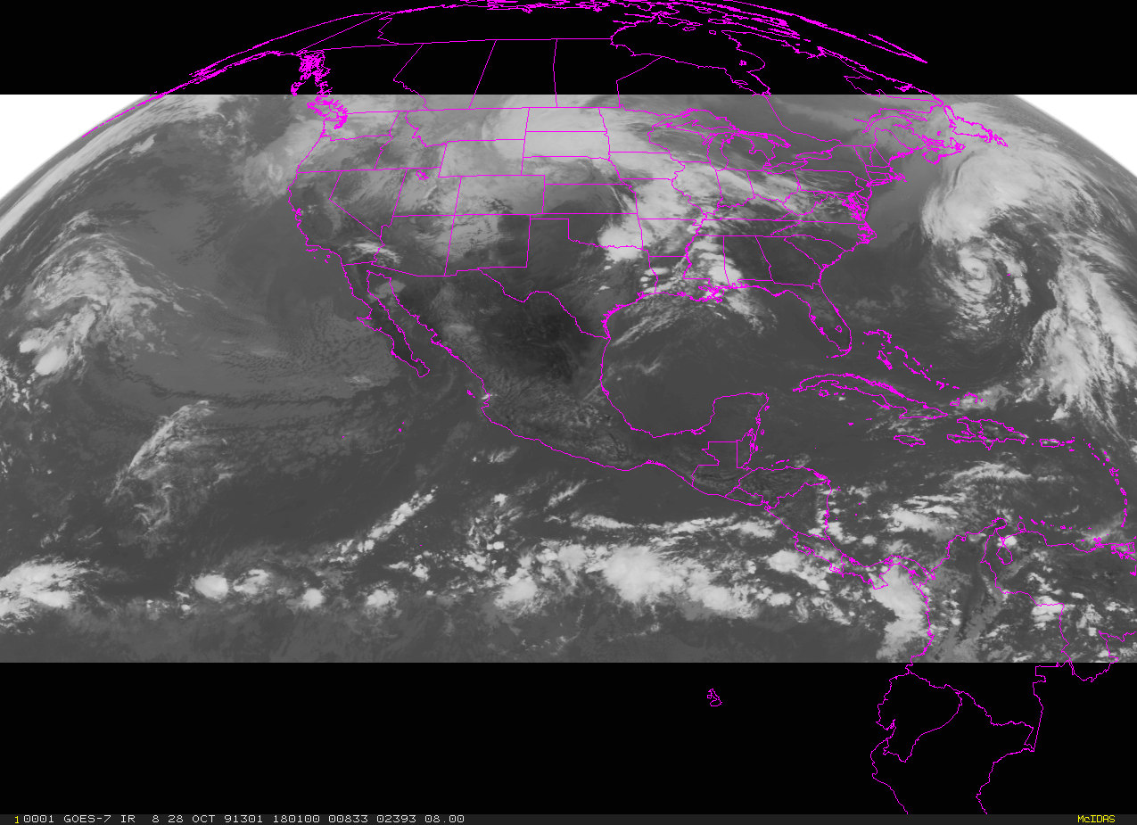
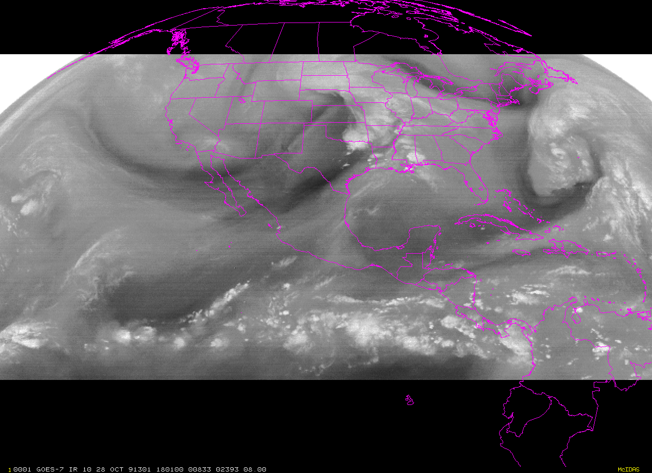
I have attached screen captures for each of the 3 bands in the image
created from:
IMGDISP GOES7/IR BAND=7 EU=IMAGE MAG=1 -2 LAT=20 100 REFRESH='EG;MAP
FILE=OUTVHPOL'
FRMSAVE 1 goes7_band7_19911028_1801.gif
IMGDISP GOES7/IR BAND=8 EU=IMAGE MAG=1 -2 LAT=20 100 REFRESH='EG;MAP
FILE=OUTVHPOL'
FRMSAVE 1 goes7_band8_19911028_1801.gif
IMGDISP GOES7/IR BAND=10 EU=H2O MAG=1 -2 LAT=20 100 REFRESH='EG;MAP
FILE=OUTVHPOL'
FRMSAVE 1 goes7_band10_19911028_1801.gif
re:
> Thanks again,
No worries.
Cheers,
Tom
--
****************************************************************************
Unidata User Support UCAR Unidata Program
(303) 497-8642 P.O. Box 3000
address@hidden Boulder, CO 80307
----------------------------------------------------------------------------
Unidata HomePage http://www.unidata.ucar.edu
****************************************************************************
Ticket Details
===================
Ticket ID: PGJ-855031
Department: Support McIDAS
Priority: Normal
Status: ClosedAttachment:
goes7_band7_19911028_1801.gif
Description: GIF image
Attachment:
goes7_band8_19911028_1801.gif
Description: GIF image
Attachment:
goes7_band10_19911028_1801.gif
Description: GIF image