
This archive contains answers to questions sent to Unidata support through mid-2025. Note that the archive is no longer being updated. We provide the archive for reference; many of the answers presented here remain technically correct, even if somewhat outdated. For the most up-to-date information on the use of NSF Unidata software and data services, please consult the Software Documentation first.
Wanhong,
As I said, the following method will perform OA on the surface file and you
should be able to plot a contour and/or fill plot, but I have not been able to
plot point data (CTYPE = P in GDCNTR) yet, and I'm not really sure why.
in OAGRID
GDFILE = oagrid.gem
DELTAN = 0.40
DELTAX = 0.20
DELTAY = 0.20
GRDAREA = 36;-90;39.25;-81.75
EXTEND = 2;2;2;2
DTAAREA =
SOURCE = SF
SNFILE =
SFFILE = dev.gem
SNPARM =
SFPARM = ptot
DATTIM = /0800
LEVELS = 10
MAXGRD = 10
r
you should see a file in your present working directory called oagrid.gem (mine
is 4.6k)
in OABSFC:
SFFILE = dev.gem
GDFILE = oagrid.gem
SFPARM = ptot
DATTIM = /0800
DTAAREA =
GUESS =
GUESFUN =
GAMMA = 0.3
SEARCH = 20
NPASS = 2
QCNTL =
OABND =
GDATTIM = last
GFUNC = ptot
GLEVEL = 0
GVCORD = none
r
oagrid.gem should now be about 6.1k.
to confirm with GDINFO:
GDFILE = oagrid.gem
LSTALL = YES
OUTPUT = T
GDATTIM = last
GLEVEL = 0
GVCORD = none
GFUNC = ptot
r
you should see:
Number of grids in file: 1
Maximum number of grids in file: 10
NUM TIME1 TIME2 LEVL1 LEVL2 VCORD PARM
1 110208/0800 0 NONE PTOT
in GDCNTR:
GDATTIM = last
GLEVEL = 0
GVCORD = none
GFUNC = ptot
GDFILE = oagrid.gem
CINT =
LINE = 3
MAP = 10/1/2
MSCALE = 0
TITLE =
DEVICE = xw
SATFIL = 0
RADFIL = 0
IMCBAR =
PROJ = mer
GAREA = 36;-90;39.25;-81.75
IJSKIP = 0
CLEAR = y
PANEL = 0
TEXT = 1/21//hw
SCALE = -1
LATLON =
HILO =
HLSYM =
CLRBAR = 24/H/LL//.80;.02
CONTUR = 0
SKIP =
FINT = 0
FLINE = 10-20
CTYPE = c
LUTFIL = 0
STNPLT =
r
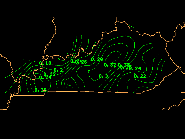
I've attached a gif image of what I see (with CTYPE = C)
Again, when I change to CTYPE = P it's not plotting grid point values as it
should. I'm still trying to figure out why.
Michael James
Unidata
> Hi Michael,
> I really appreciate your help. We will remove numbers on maps if the
> floating data
> can not be ploted on the map using sfmap. Please email me the scripts
> using OAGRID and
> OABSFC if you could(even you don't finish that script), I will test that
> and we will
> use that later.
>
> Thanks.
>
> Wanhong Wang
> System Admin/Prog.
> UK Weather Center
>
>
>
>
> On 2011-2-9 21:39, Unidata GEMPAK Support wrote:
> > Unfortunately floating points are not able to be plotted in SFMAP.
> >
> > Two solutions I have are 1) use SFPARM = ptot*100 to display precip to
> > hundredths of inches but without the decimal point, or 2) use OAGRID and
> > OABSFC to grid the surface precip obs to plot on top of contoured model
> > forecast values.
> >
> > I've done option 2 here on my end but can't seem to display point values
> > (TYPE = P) for the PTOT grid and I'm not sure why. If option 1 works for
> > you then no bother, otherwise I'll have to look at this again tomorrow.
> >
> > best,
> >
> > Michael
> >
> >
> >
> >> Hi Michael James,
> >>
> >> I got error message when try to upload the files. I put all file
> >> on following link, you may get all you want.
> >>
> >> http://weather.uky.edu/ldm-images/shared/
> >>
> >> dev.gem 09-Feb-2011 18:59 22K
> >> dev.grd 09-Feb-2011 18:59 38K
> >> gemglb.nts 09-Feb-2011 18:59 22K
> >> kypm30d_prec.fin 09-Feb-2011 18:59 2.2K
> >> kypm30d_prec.gif 09-Feb-2011 19:00 29K
> >> kypm_prec.csh 09-Feb-2011 19:00 3.5K
> >> kypmsites.tbl 09-Feb-2011 19:00 5.4K
> >>
> >>
> >> We got map, but we want print the rainfall real data on the map,
> >> not as integer...
> >>
> >> http://weather.uky.edu/ldm-images/shared/kypm30d_prec.gif
> >>
> >>
> >>
> >>
> >>
> >>
> >> -------- Original Message --------
> >> Subject: Fwd: [GEMPAK #ZGN-126493]: Fwd: Fwd: KY PM 7 Days data and map
> >> Date: Wed, 9 Feb 2011 18:26:57 -0500
> >> From: Priddy, Kenny T<address@hidden>
> >> To: Wang, Wanhong<address@hidden>
> >>
> >>
> >>
> >>
> >>
> >> Sent from my iPhone
> >>
> >> Begin forwarded message:
> >>
> >>> *From:* Unidata GEMPAK Support<address@hidden
> >>> <mailto:address@hidden>>
> >>> *Date:* February 9, 2011 2:46:55 PM EST
> >>> *To:* "Priddy, Kenny T"<address@hidden<mailto:address@hidden>>
> >>> *Cc:* "address@hidden
> >>> <mailto:address@hidden>"
> >>> <address@hidden<mailto:address@hidden>>
> >>> *Subject:* *[GEMPAK #ZGN-126493]: Fwd: Fwd: KY PM 7 Days data and map*
> >>> *Reply-To:* "address@hidden
> >>> <mailto:address@hidden>"
> >>> <address@hidden<mailto:address@hidden>>
> >>>
> >>> I'm not sure if you attached the mesonet obs grid (dev.grd?) or if it
> >>> was stripped by our mail server, which happens occasionally.
> >>>
> >>> Can you upload the file for me at the GEMPAK support repository?
> >>>
> >>> http://motherlode.ucar.edu/repository/alias/gempakuploads/
> >>>
> >>> Thanks,
> >>>
> >>> Michael James
> >>> Unidata
> >>>
> >>>
> >>>> Can y'all help? I tried our local authority....Gilbert....but no luck.
> >>>> We want to print rainfall values of our Mesonet sites using a gempak
> >>>> script...
> >>>> but all we can get to print is interger values of rainfall. Is that one
> >>>> of the parameters
> >>>> in the script? Any help is appreciated.
> >>>>
> >>>> -------- Original Message --------
> >>>> Subject: Fwd: KY PM 7 Days data and map
> >>>> Date: Wed, 09 Feb 2011 12:52:03 -0500
> >>>> From: Tom Priddy<address@hidden<mailto:address@hidden>>
> >>>> To: Gilbert Sebenste<address@hidden
> >>>> <mailto:address@hidden>>, wwang
> >>>> <address@hidden<mailto:address@hidden>>
> >>>>
> >>>>
> >>>>
> >>>> From: Tom Priddy
> >>>>
> >>>> Hey, Gilbert. Here's a question we've been scratching our heads on....
> >>>>
> >>>> We want to print rainfall values of our Mesonet sites using a gempak
> >>>> script...
> >>>> but all we can get to print is interger values. Is that one of the
> >>>> parameters
> >>>> in the script?
> >>>>
> >>>>
> >>>> -------- Original Message --------
> >>>> Subject: KY PM 7 Days data and map
> >>>> Date: Wed, 9 Feb 2011 12:44:22 -0500
> >>>> From: Wang, Wanhong<address@hidden<mailto:address@hidden>>
> >>>> To: Priddy, Kenny T<address@hidden<mailto:address@hidden>>
> >>>>
> >>>>
> >>>>
> >>>>
> >>>>
> >>>>
> >>>> how to change parameters to print a number(1.22) as decimal
> >>>> fraction(1.22 or 1.2) not as integer(1)?
> >>>>
> >>>>
> >>>> The maps:
> >>>>
> >>>>
> >>>>
> >>>>
> >>>>
> >>>> the programs used for creating maps:
> >>>>
> >>>> gdcntr<< EOF6
> >>>> \$RESPOND = no
> >>>> \$MAPFIL = hipowo.cia + hicnus.gsf
> >>>> GDATTIM = /0800
> >>>> GLEVEL = 0
> >>>> GVCORD = none
> >>>> GFUNC = ptot
> >>>> GDFILE = dev.grd
> >>>> CINT = ${int}
> >>>> LINE = 2/1
> >>>> MAP = 10/1/2 + 10/10/1
> >>>> TITLE = 24/-2/${ddate2} - ${titleinfo} (inches)
> >>>> DEVICE = ${device}
> >>>> SATFIL =
> >>>> RADFIL =
> >>>> PROJ = mer
> >>>> GAREA = 36;-90;39.25;-81.75
> >>>> CLEAR = yes
> >>>> PANEL =
> >>>> TEXT = 1/21//hw
> >>>> SCALE = 0
> >>>> LATLON = 0
> >>>> HILO = 0
> >>>> HLSYM = 0
> >>>> CLRBAR = 24/H/LL//.80;.02
> >>>> CONTUR = 0
> >>>> SKIP =
> >>>> FINT = ${int}
> >>>> FLINE = 101;21-30;4
> >>>> CTYPE = c/f
> >>>> LUTFIL = 0
> >>>> STNPLT = 0
> >>>> run
> >>>>
> >>>> exit
> >>>> EOF6
> >>>>
> >>>> sfmap<< EOF5a
> >>>> \$RESPOND = no
> >>>> \$MAPFIL = hipowo.cia + hicnus.gsf
> >>>> AREA = 36;-90;39.25;-81.75
> >>>> GAREA = 36;-90;39.25;-81.75
> >>>> SATFIL = 0
> >>>> RADFIL = 0
> >>>> SFPARM = ptot
> >>>> DATTIM = /0800
> >>>> SFFILE = dev.gem
> >>>> COLORS =
> >>>> MAP = 10/1/2 + 10/10/1
> >>>> LATLON =
> >>>> MARKER = 0
> >>>> TITLE = 24/-1/${titleinfo2}
> >>>> CLEAR = no
> >>>> PANEL = 0
> >>>> DEVICE = ${device}
> >>>> PROJ = mer
> >>>> FILTER = no
> >>>> TEXT = 1/21//hw
> >>>> SKPMIS = 0
> >>>> LUTFIL = 0
> >>>> STNPLT = 0|31/5/1.25/1.25|${tbl}
> >>>> run
> >>>>
> >>>> exit
> >>>> EOF5a
> >>>>
> >>>>
> >>>> attached data file
> >>>>
> >>>>
> >>>>
> >>>>
> >>>>
> >>>
> >>> Ticket Details
> >>> ===================
> >>> Ticket ID: ZGN-126493
> >>> Department: Support GEMPAK
> >>> Priority: Normal
> >>> Status: Open
> >>>
> >>
> >
> > Ticket Details
> > ===================
> > Ticket ID: ZGN-126493
> > Department: Support GEMPAK
> > Priority: Normal
> > Status: Open
> >
>
>
Ticket Details
===================
Ticket ID: ZGN-126493
Department: Support GEMPAK
Priority: High
Status: OpenAttachment:
meso.gif
Description: GIF image