
This archive contains answers to questions sent to Unidata support through mid-2025. Note that the archive is no longer being updated. We provide the archive for reference; many of the answers presented here remain technically correct, even if somewhat outdated. For the most up-to-date information on the use of NSF Unidata software and data services, please consult the Software Documentation first.
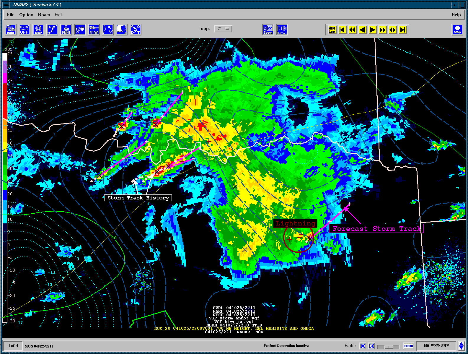
Ray,

As I mentioned before, the NEXRAD Level III products that provide the
individual graphical elements are able to be displayed and overlaid.

The NCR product iself contains the text table at the end, but this is not the
graphical element.
Instead, use the products which provide the graphical elememnts.

The STI product provides the store track graphical elements:
ftp://tgftp.nws.noaa.gov/SL.us008001/DF.of/DC.radar/DS.58sti

These can be overlaid on the radar imagery such as I have shown here by
creating a VGF file first:
http://www.unidata.ucar.edu/software/gempak/examples/nmap2/gempak_storm_example.gif

I display the image, and then add the VGF data set of the STI, MESO, TVS, HAIL
etc.
All of these products are found on the NWS ftp server using the naming
conventions
shown here:
http://www.nws.noaa.gov/tg/radfiles.html

Steve Chiswell
Unidata User Support


> Steve et al, anything else done to allow plotting of the NCR
> product with nmap2? Will STI overlay on an existing image
> within nmap2?
>
> Storm location and/or track plotting would be a big plus for NMAP,
> even if its just the location data from az/distance thats in the NCR.
>
> NCR contains everything needed for all this, but in text form, would
> need math to make it into lat/lon data.
>
> I tried to figure out how to do that with the gempak lib stuff once,
> but ran out of time.
>
> Ray Weber
> Ma Skywarn
>
>


Ticket Details
===================
Ticket ID: YAM-179413
Department: Support GEMPAK
Priority: Urgent
Status: Closed