
This archive contains answers to questions sent to Unidata support through mid-2025. Note that the archive is no longer being updated. We provide the archive for reference; many of the answers presented here remain technically correct, even if somewhat outdated. For the most up-to-date information on the use of NSF Unidata software and data services, please consult the Software Documentation first.
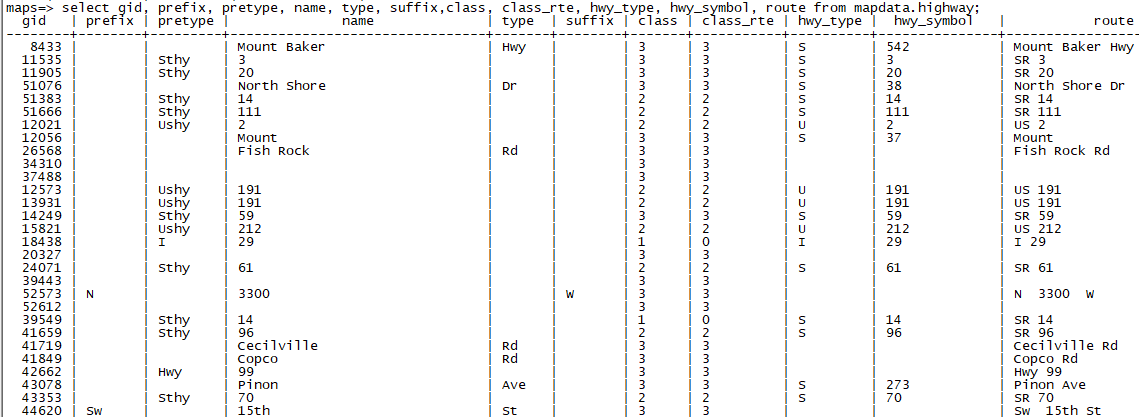
The hwy_type is probably the most applicable and those options can be:

U (US)
S (State)
I (Interstate)
C (County)
  (Blank)

Highway symbol is the number it references. I've attached some example output
from the maps highway database.


Thanks,

Tiffany Meyer
AWIPS Lead Software Engineer
NSF Unidata

If you're interested, please feel free to fill out a survey about the support
you receive:
https://docs.google.com/forms/d/e/1FAIpQLSeDIkdk8qUMgq8ZdM4jhP-ubJPUOr-mJMQgxInwoAWoV5QcOw/viewform

Ticket Details
===================
Ticket ID: DWE-831183
Department: Support AWIPS
Priority: Normal
Status: Open
===================
NOTE: All email exchanges with NSF Unidata User Support are recorded in the
Unidata inquiry tracking system and then made publicly available through the
web.  If you do not want to have your interactions made available in this way,
you must let us know in each email you send to us.
Attachment:
maps_database.png
Description: PNG image