
This archive contains answers to questions sent to Unidata support through mid-2025. Note that the archive is no longer being updated. We provide the archive for reference; many of the answers presented here remain technically correct, even if somewhat outdated. For the most up-to-date information on the use of NSF Unidata software and data services, please consult the Software Documentation first.
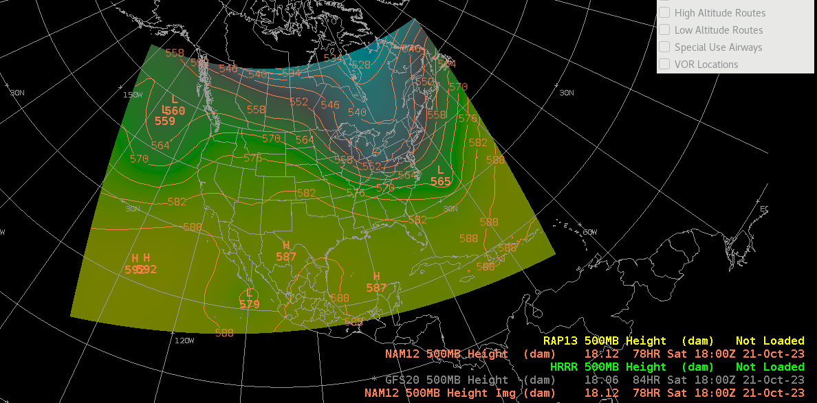
Hi there,

Just to clarify, since the NAM is the North American Model, it only has
coverage around the
continental United States.  I've attached a screenshot with it loaded as an
image as well
so you can see the full coverage.  The contour doesn't show much data in the
south west of
the model because it's uniform in that area right now.

Let me know if that makes sense?

--Shay Carter

She/Her/Hers
AWIPS Software Engineer
UCAR - Unidata

If you're interested, please feel free to fill out a survey about the support
you receive:
https://docs.google.com/forms/d/e/1FAIpQLSeDIkdk8qUMgq8ZdM4jhP-ubJPUOr-mJMQgxInwoAWoV5QcOw/viewform

Ticket Details
===================
Ticket ID: WJV-453958
Department: Support AWIPS
Priority: Normal
Status: Open
===================
NOTE: All email exchanges with Unidata User Support are recorded in the Unidata
inquiry tracking system and then made publicly available through the web.  If
you do not want to have your interactions made available in this way, you must
let us know in each email you send to us.
Attachment:
image (52).png
Description: PNG image