
This archive contains answers to questions sent to Unidata support through mid-2025. Note that the archive is no longer being updated. We provide the archive for reference; many of the answers presented here remain technically correct, even if somewhat outdated. For the most up-to-date information on the use of NSF Unidata software and data services, please consult the Software Documentation first.
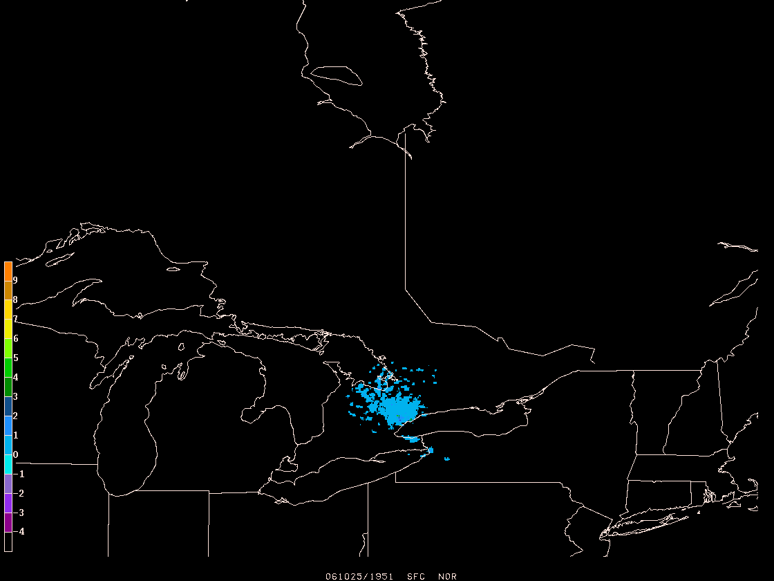
Stephen,

I was able to convert your data to a grid by adapting the gdradr program.
This will use a series of individual station files and composite them
into a single grid for display. It takes about 0.5 seconds to convert the file
you provided me which comprises 8538 lat/lon/value groups. For 30 stations or
so,
this would only take as long as it takes to read the data from the disk files.

The pattern I plotted is basically a ground clutter pattern. At this point,
I would be helpful if you could provide a set of your files for several
stations
where some weather is occuring so I can test things out. Otherwise, I can send
you the
routine as I have it now so that you can verify point locations.

I have attached a plot based on the data you sent me.

Steve Chiswell
Unidata User Support

>
> Hi.
>
> I am trying to quickly import the Canadian Numeric Ascci RADAR data files
> into either a GINI or GEMPAK grid file for use in GEMPAK.
>
> I have included a sample file, and would appreciate any help or suggestions
> in how to proceed.
>
> Thanks
>
> Stephen Sinnis
> The Weather Network
>
>
>


Ticket Details
===================
Ticket ID: YTR-838531
Department: Support GEMPAK
Priority: Urgent
Status: Closed
Attachment:
wkr.gif
Description: GIF image